FIRST Survey Catalogs
A source catalog including peak and integrated flux densities and size
information derived from fitting two-dimensional Gaussians to the
sources is generated from the coadded images. The astrometric
reference frame of the maps is accurate to 0.05", and individual
sources have 90% confidence error circles of radius < 0.5" at the 3 mJy
level and 1" at the survey threshold.
The survey area has been chosen to coincide with that of the
Sloan Digital Sky Survey (SDSS);
at the mv~23 limit of SDSS, ~30% of the optical
counterparts to FIRST sources are detected.
unambiguous optical identifications (<5% false rates) are achievable to
mv~24.
A catalog from the 1993 through 2011 images (containing ~946,000
sources and covering ~10,575 square degrees) has been constructed and
tested to ensure reliability and completeness. The current version
(14dec17) of the catalog is available as either a compressed ASCII file
or a FITS binary table.
Please read the catalog description
for information on retrieving the catalog, the file format and catalog
limitations. A paper is
available that describes in depth the FIRST catalog construction. The
current catalog is most easily accessed through the
FIRST Search Page,
which can be used to search the FIRST catalog by position and/or by
other catalog parameters.
The current sky area covered is shown in the coverage
maps below:
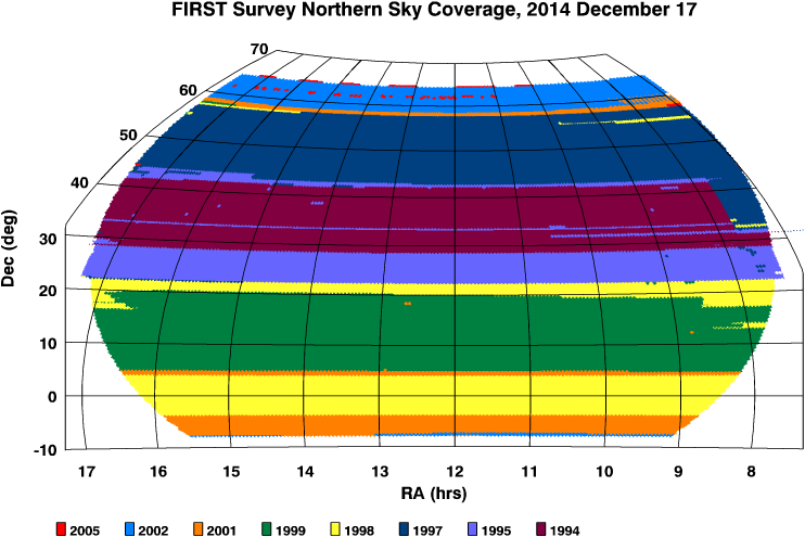
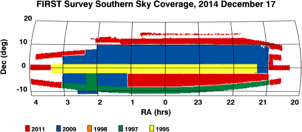
These coverage maps are available
in several different formats, including FITS versions that give the
rms noise as a function of sky position.
Previously released versions of the catalog are still
accessible; see the catalog history
for information on changes in the released versions.
Richard L. White, rlw@stsci.edu
2014 December 17